Wednesday 21 October 2015

Hiking kit essentials 1

What do I put all that kit in?

It is always important to carry some essential items with you when you are out hiking. I carry different things for summer and spring/autumn/winter - the latter three are cooler and the days are shorter. Of course, that means I can sometimes get caught out, like I did the other day on Great Shunner Fell, due to not thinking about the change in season - that could have been disastrous, as I was totally unprepared for the possibility of spending the night on the fell. I had assumed I would be back at the car well before the sun set - and we all know what they say about it when you assume anything: it makes an ass out of u and me!

So I thought writing a blog post about essential kit would be helpful, first to remind myself what I ought to have with me and, second, to help anyone else who might be thinking of taking a day hike and not knowing what to take with them.

Does carrying all that kit make the rucksack heavy? Well, yes, but not unwieldy. I would rather have kit I didn't use than not have kit I needed in an emergency. The worry would have been relieved immensely on Great Shunner Fell had I had a simple additional item - a torch! But there would have been no panic at all if I had carried my usual autumn/winter kit. This is going to take more than one post (five in all) to cover all the kit adequately, without giving you too much to read and scroll through in one go):
what to carry it all in;
clothing essentials; 
the kit inside the pack/pockets; 
food supplies; 
first aid kit)

First of all, a rucksack is obviously essential to carry it all in, but not just any rucksack - it needs to be well fitting and small enough not to be a burden while at the same time being big enough to carry the kit. Like with shoes, people are different sizes and rucksacks are not really a 'one size fits all' item. A good supply store should have people who are experienced in making sure the rucksack fits properly, so try a few and just ask.

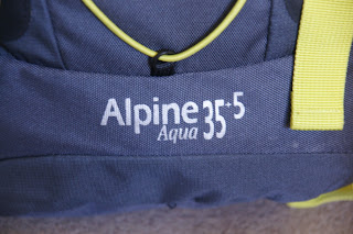
I carry an Alpine Aqua 35+5, which is available from Blacks. It is grey with bright yellow straps. At first, I thought the straps were a bit too bright - more like a fashion statement than a hiking pack - but then again, if I were to get lost in fog, they actually stand out like a fluorescent jacket.


The main body of the pack is 35 litres; it has a top pack 'lid' which measures 5 litres. I'm not sure why they measure in litres, because really, you aren't going to fill them with water to carry around - well, not on purpose anyway. I suppose it is just that they are difficult to measure, as these days they are shaped to allow the air to circulate around your back, so you don't get too hot and therefore damp with perspiration. The physical measurements however are:

17.5" tall (minus the 'lid' part)
11"wide (when the side pockets are empty)
8" deep, front to back, measured at the base of the pack
The lid adds another 4.5" to the height at the back, seen here as the part standing above the shoulder straps:


In any event, it is large enough for all my needs when out on a day hike (I have a much larger pack for if/when I have planned to stay out overnight - the important word being 'planned').

It closes using a system I hadn't come across before and while it is fiddly, once you get used to it, it isn't a problem. Each compartment (the main body and the lid), has a bag-like bit sticking out of the top. This ends in a hard/firm strip on either side of the opening. The strips are held together and the bag part is rolled up (directions for which way to roll are printed on the pack), then the ends, which have a buckle on, are closed into the other half of the buckle on the outside of the pack. This has the advantage of making doubly sure that the contents remain dry should it rain heavily while you are out. I probably haven't explained that very well, so here is a series of photos showing the process:


There are two side pockets and a front pocket too. The front pocket will take a map and not much else; 


the side pockets are each quite big enough to take a 1 litre water bottle comfortably.


On the outside, there are two mesh pockets. I don't tend to use these, as I don't have anything I need to get at quickly that isn't already in my jacket pockets. I suppose I could put my water bottle or walking poles in them (the poles would also need to be tied in with the straps or they will just fall out), which would free up a side pocket for something else, like hats, gloves or food supplies.

The shoulder straps are padded and are adjustable. 


The waistband is also padded on the hips. 


This was an essential requirement when I was looking to replace my previous rucksack. The weight of the pack should sit on your hips. If the hip strap is not padded, then it can chafe or dig in and be very uncomfortable. The waistband needs to be tight enough to allow the pack to sit firmly on the hips, so the hips take the weight. Otherwise, the weight is hanging off your shoulders and that only leads to back aches, sore shoulders and a crick in the neck! I have lost some weight recently and had failed to re-adjust the waist straps when I went up Great Shunner Fell. By the time I reached the top, my shoulders were aching considerably. Adjusting the waist strap soon solved that problem. I do however need to adjust it again, as from now on I will be carrying a greater weight, which can also make the pack drag on your shoulders.

Another nice feature is that there are molle type straps on the front, so if I wanted to attach a secondary pack, or a separate first aid kit, I could do so easily. There is also an elasticated strap zigzagged up the front of the pack, which might be a better place for the hiking poles, or a camera tripod, if you are a keen photographer. You could probably fit your roll mat vertically up there too.


At the bottom of the bag is another zipped pocket, in which the rucksack's waterproof cover is neatly stowed. In theory, it is possible to access this while the pack is still on your back and, with a bit of a wiggle, get the rain cover over the pack without ever taking the rucksack off. However, this is something I have yet to master! As a bonus, the cover is actually attached to the bag, so it can't blow away if it's windy and you can't lose it or leave it home accidentally. 


For most light showers, the pack is waterproof enough, but persistent drizzle or a heavier shower, or indeed a downpour, and you would need the cover. All the zips are covered by flaps, so light rain should not penetrate and seep through the fabric zip edges.

Finally, there is a chest strap, which prevents the shoulder straps from falling sideways and pulling on your shoulders. The buckle is made of bright orange plastic and has a whistle on it. I haven't used the whistle yet, so I have no idea how loud it is.


The only thing it seems to lack are D rings for attaching things externally (like a camp mug for instance) using a karabiner, but as it is for day use only, it is not really necessary. In any case, there are several loops made of webbing that could be very useful instead of D rings.


Next post: Clothing Essentials

Tuesday 20 October 2015

Harkerside and Apedale

Guide Book: 80 Dales Walks, Paul Hannon, (1989)

Map: OL30

Unfortunately for Storm, she has come into season and so is unable to go anywhere for three weeks, so once again, I set off by myself. As it happens, we met no-one and no other dogs, so it wouldn't have been a problem, but you can't know that in advance.


Just to show she's not forgotten, even if she couldn't come with me.

I drove to Grinton; where the road bears right to continue to Reeth, I turned left and headed up towards Grinton Lodge. Once a shooting lodge, it is now a Youth Hostel. Some years ago, the YHA sold off several of their hostels; sadly this wasn't one of them. Had it been, I might well be living in it now!


Just before reaching the hostel,a short distance above Grinton, a road turns to the right, headed towards Redmire. This road is known as the Redmire Moor road and is the road James Herriot was travelling when he got out of his car, lay on the grass verge and decided this was where he wanted to spend the rest of his life. There is a small car park at the junction, so I parked there. 


Heading up the road a little way, I found the track (bridleway) running to the right. It might not have been the right path, as there are several up this road and the guide book is not clear as to which one to take. 


Anyway, the directions made sense and corresponded with what was happening on the ground. I found the fence mentioned 


and then walked down the gully to cross a small stream, then climbed again to reach the fence on the opposite side. 


The path passed earth works and Maiden Castle (nothing left but a circle on the ground, which is best seen from above. 


I also passed a small pond (very green) and there was a grave next to it - a loved dog perhaps?


After a while, the path vanished entirely, so I climbed to higher ground to see if I could see where the path reappeared. From the height, it was obvious where the path went, so I returned to the lower level and followed a rabbit track across the heather till I rejoined the path.

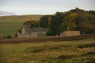
I really liked this composition with the farmhouse, the tree and the hills all around:
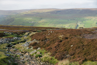


I was now much higher and the views all around were amazing - I could see almost the whole of Swaledale in front and behind - well, it felt like that, anyway. Once again, the heather burners were out in force, but thankfully they were far enough away that I only got a whiff occasionally.


Eventually, I came to a junction where I stopped on a suitable rock for some lunch. I had set off about half past eleven and it was now 1.20pm. After lunch, I turned left and headed up hill, eventually joining a wide track. I turned right and shortly came across a hut. 


The guide book describes it as a 'large shooting hut'. At this point, I realised a lot can change in 26 years! The guide book was published in 1989 and there were frequent comments about 'sketchy paths', 'grassy tracks' and so on. In fact, the track underfoot was a well maintained gravel path, wide and solid enough for vehicles. However, it deviated somewhat from the path marked by cairns mentioned in the book. I could see the cairns way off to my right and a faint possible path. It seemed sensible to stick to the proper path, so I did, keeping a watch on the original line of the path, just in case it went off at a tangent.

One of the cairns:


You can just make out the original path - a grassy strip wending its way past the cairns:


Another cairn, described in the guide books as 'a conspicuous shapely cairn'. Sadly the path does not pass  by it any more, but you can just see it from the track:


There were two grouse butts and a stream that I was supposed to keep on my left, but the new track has them to my right:


The stream bed was dry, as were many of the others I passed. Only one had any water in and that was not running, but lying in the bottom of the bed. We have had a particularly dry October this year.

The track continued to another junction, where a large spoil heap lay at the base of a rather devastated section of land. 


The original path went through the devastation (caused by mine workings, long since ceased); the track bypassed the original track, but continued in the same direction. Just before I reached a fence, the track and the original path converged, as indicated by the presence of a large cairn.


Passing through a gate in the fence, I was now at the head of Apedale, with Gibbon Hill to my left. I admit to wondering which came first - the monkey or the ape??


Apedale is lovely! It stretched ahead with little or no sign of human involvement, apart from the ever present smoke on the horizons, the grouse butts that were everywhere, and the track beneath my feet. There was no sound except the wind in my ears and the sound of the grouse (grice? lol) in the heather.

It was a long downhill stretch to Dent's Houses, passing more mine workings. There certainly was a lot of activity in these dales, but now it is silent and nature is reclaiming its territory:


There was a false trail at one point, but there were no houses (there weren't actually any at Dent's either) and the crossroads I was expecting wasn't quite a crossroad. So I ignored it and continued along the path, finally arriving at the real Dent's Houses. There was a barn and a small building that could have been a house at one time I suppose, but neither was inhabited. And there was a proper crossroads. 


At this point, I turned left and headed once again up hill to the top of Greets Hill. Having already walked about 8 or 9 miles, uphill was not really welcome. 


If I had continued straight ahead, I would have come to the moor road (the Redmire Road, as it happens) and could have followed it downhill, but that would have been 4-5 miles on the road. Instead, I took the left turn and walked over a mile uphill.

Is this the top?


Nope. This one perhaps?


No again, but this is!


I finally arrived at another fence. Once through the fence, this was the last leg of the walk. The path was now just a narrow mown strip in the heather; 


shortly afterwards it became a rocky path that was quite hard to walk on, 


but soon after that, it turned to a wide grassy path. 


I passed yet more mine workings (disused now of course) and headed downhill. The path turned to the right. This then led to the road. An alternative was suggested in the book, to follow an indistinct grassy path straight on (instead of turning right), eventually returning to the path I started on. I chose to take the right turn and quite quickly came to the road. I might have made a different decision had I realised quite how far I was from the junction where I had left my car.


They were still burning the heather on Grinton Moor. Just how do they make it burn in straight lines and, more to the point, how do they manage to make it burn just the section they want and stop it from burning the entire moor?


I walked about 2 miles down the road. Fortunately there is a wide grassy edge to the road, so I wasn't actually walking on the tarcmac. The road was 'busy' - 9 cars, 1 FWD, three white vans, a cyclist and a bus. Technically the bus didn't pass me; it turned round in the mouth of the junction as I approached.

I got back to the car at 5.33pm, so still within daylight and only half an hour later than my estimated time. I had walked about 11 miles. As I arrived, the sun was just sinking below the hills behind me.