Burneside to
Bowness J
18/6/2017
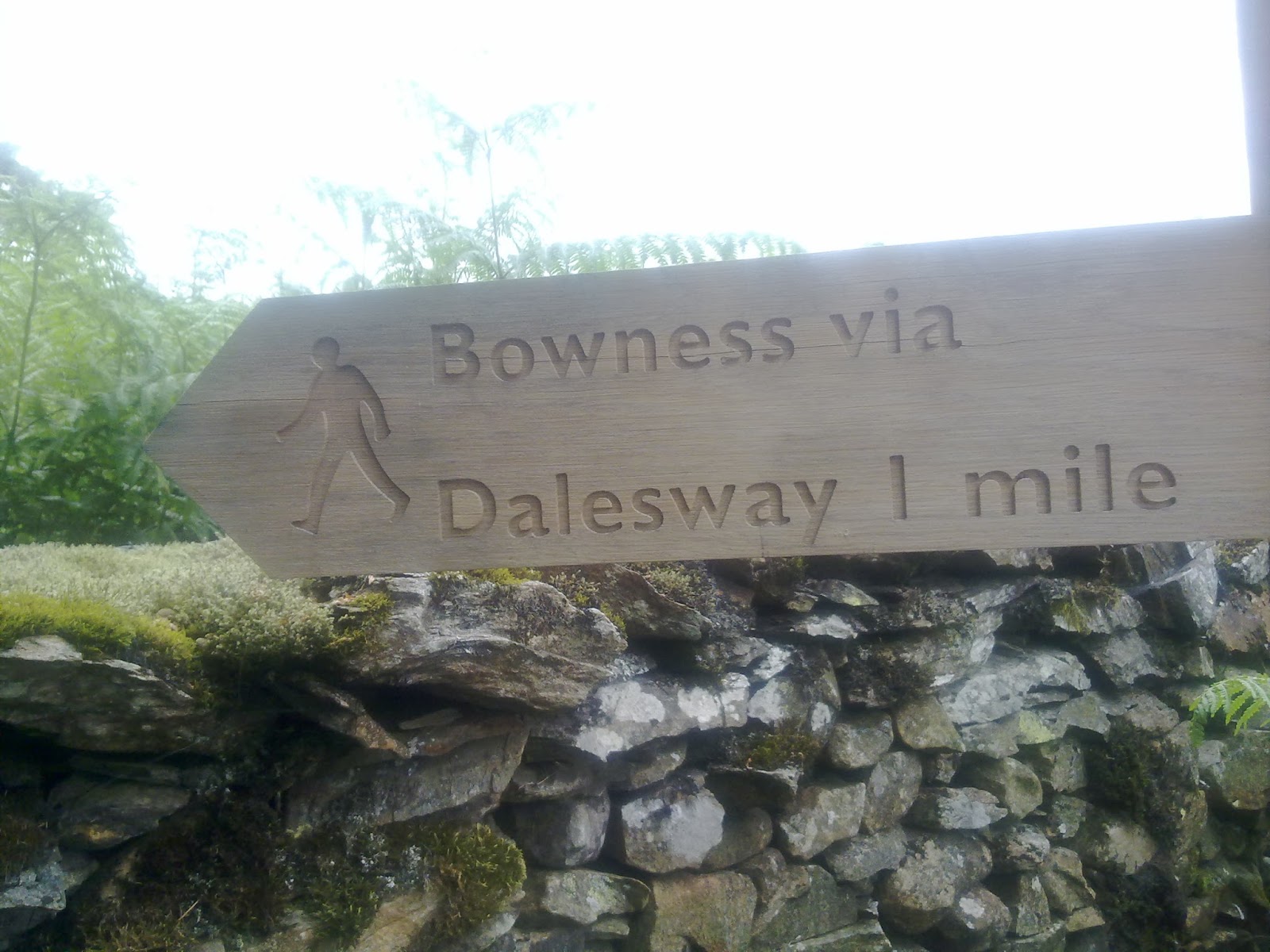
At last, the
end of the walk is in sight J
Well, back
to Burneside and off towards Bowston. As it happened, there wasn’t much to
photograph of interest in Burneside from the car park so I didn’t take any
pictures at this point, except, of course, the signpost showing where I was
headed

The path was
well defined, if a little confined

…but the
views across to the hills were good

I followed
the river, again on my left side as I travelled west. The landscape yesterday
and today is noticeably different from what preceded it. more rolling hills and
meadows, whereas before, it had been much more rugged. Still, that is not a
complaint – it was really pleasant walking along the side of the river here.


Not quite
sure why there is a stump of an old tree right in the middle of the water
though

A little
past the stump was a lovely house just being built; unfortunately, I seem to
have been a little giddy when taking this, or else the builders have made a
huge mistake as the house is leaning precariously!!

The path
ended at some steps up to a road over yet another bridge

…but this
bridge was a little different, built from a different material – still stone,
but flatter instead of chunky rocks

Nearby was
an old Victorian post box set into a wall

Another road
section

…signposted
to Staveley

…and leading
to and through Cowan Head. This was a huge estate which has been renovated and
turned into flats

But the
latter part of the village is still as quaint as when it was first built

Just after this, I met some students doing their D of E. Not sure what they had done with their map, but they found it necessary to ask if the path crossed the river. I had obviously crossed it myself at some point, but it was so far back, I could barely remember! Anyway, I told them which way to follow at a tricky bit; I hope they found their route. If they had continued along the road past the path junction (which wasn't easy to realise was the actual path they needed), they could have been taken miles off their course.
Sometimes
the signs have been difficult to see, some even difficult to find, but who on
earth put this one here?? Is this what they call 'hiding in plain sight'?

I had
crossed the river a way back and was now walking along with the water to
my right, but still walking through meadows. Ahead was an enormous barn

It was
fenced off as clearly it is currently unsafe, but it looks like someone is
trying to renovate it

The gate
immediately after it had the most enormous gateposts for a simple field gate!

…and at the
end of the next field, another two enormous gateposts, with the gap walled up

The path
followed through several fields after this, mostly flat and somewhat
featureless, but pleasant none the less

Of course,
at every field boundary there was a ladder stile to clamber over

Then on
through a lightly wooded area

And to a
gate that was firmly locked.

Reading the
instructions again (three times) and puzzling over the map didn’t help at all.
But before I decided to climb over the gate, I retraced my steps a few yards to
see if I had missed anything. Indeed I had – to the left of the locked gate was
a stile with a gate on it in the wall, hidden behind bushes and tall grass. I
just caught a glimpse of the Dales Way sign on the gatepost and headed over to
it, thankful for not having to walk through a field full of cows.
The open
field eventually was directed to a green lane between two walls

..at the end
of which was a gate with a sign that could not have been clearer

Once again
we were passing through flat fields and meadow land

The clouds
were coming in and it looked as though it might rain (again)

The path
headed under a railway bridge

…where just
beyond it was a clump of lysimachia growing, looking lovely with its bright
yellow flowers

Soon I was
at the half way point of today's walk; a signpost clearly announcing 5½ miles
left to go

I was quite
excited by the prospect of finishing J
I passed a
farm where they had several horses and climbed the hill beyond to a stile

As I reached
the stile, I encountered a lovely older couple. Sadly he has dementia and so
they can’t walk like they used to in case something happens to her while they
are out and about, as he wouldn’t know what to do. He was 80 and she was 75 –
she looked about 60! She wished me well and said she wished she was going with
me. You can just see them walking down the hill I had just climbed:

Crossing the
hill, I came to yet another farm

They clearly
have a bit of an issue with their cattle and walker’s dogs L

The views
from the top of the next rise were wonderful. I might not like ‘up’ but the
climb is always worth the effort

The lady I had
met earlier had said something about being in sight of Bowness when you reach a
stand of pine trees. Was this the stand she meant?

Clearly not,
for I couldn’t see anything resembling a town in any direction!
The terrain
changed dramatically – meadow between huge boulders!

Another gate,
this time at a place with the quaint and unusual name of ‘Outrun Nook’

The path
couldn’t have been signposted more clearly:

The views
towards the Lake district were stunning

I came to a
junction on the path which the guide book told me was marked by four pine
trees. Sadly only one is left standing, while at least one of the others was
lying forlornly on the ground, uprooted by some storm or other no doubt and
showing evidence of its age


A short way
further on, I saw what looked like OH standing on the top of a hill nearby. I waved
enthusiastically but the person turned away and left the promontory. I thought
he might have been coming down off the hill to meet me. However, it turned out
that I had been waving at some random stranger as OH hadn’t been there at all!
A short way further
on, another junction told me that Lake Windermere was a mere ¼ mile to the
right. My path however went left. I was tempted, but decided against going to
the lake as my blistered foot was really sore now and I was limping along. I
didn’t want to jeopardise finishing the walk and I’d see Windermere soon enough
when I arrived at Bowness

I turned
left towards Hag End
The lane
came onto the road, kind of, but there was a path right next to the actual
road, separated by a stone wall. Here I found a sign telling me Bowness was another
mile further on

At the other
end of that pathway was another sign. What gets further the closer you get?
Obviously Bowness – I was still a mile away!

I think it
was the longest mile I had ever walked! More fields to pass through and then…
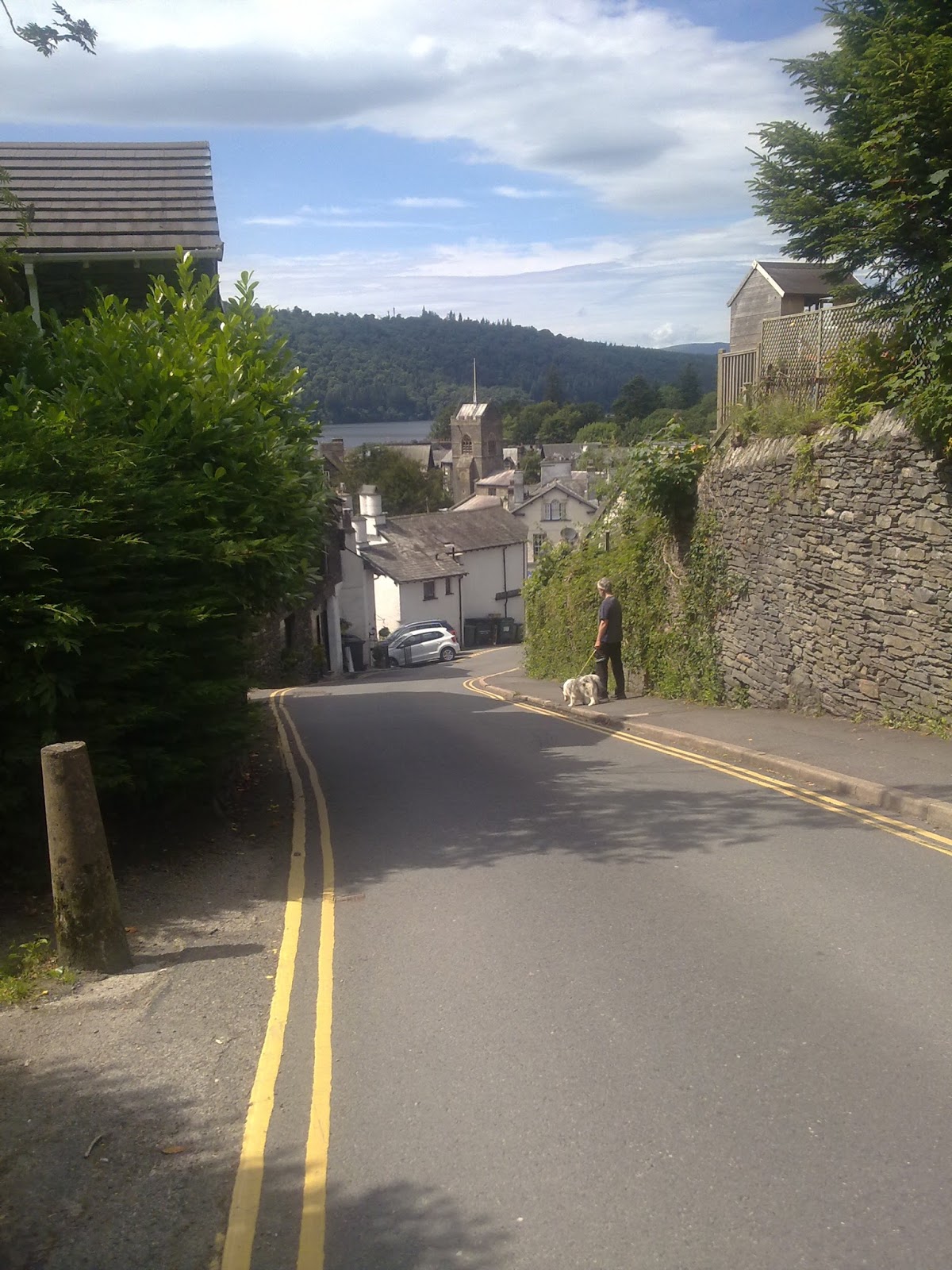
Finally I
could see Bowness, or at least the very edge of it

A stone
pillar attached to a slate seat was at the top of the hill as Bowness came into
view, marked ‘for those who walk the Dales Way’; you can just see the structure in the photo above

On the other
side was a sign saying ‘Ilkley 81 miles’ – since the walk is actually 84 miles
long, I hoped this didn’t mean I still had three miles to go!

Looking back
where I had just walked:

It was now
just a matter of walking down the hill into the town J
The path
soon gave way to road
At the
bottom was a pub called the Royal Oak; it claimed to be the official end of the Dales Way;
whether it actually is or not remained to be seen

Anyway, we
entered. Dogs were welcome,

…so we took
Storm in with us and sat in a corner while I ate a well earned meal and had a
glass of wine to celebrate
Some women I
had met on the last stretch arrived shortly after I did (I’d overtaken them
where the path paralleled the road between the walls) and ordered Prosecco for
their celebration – I thought I must do that next time too – when you have just
walked 84 miles and given yourself a sore foot, Prosecco is a good way to
celebrate/commiserate J
Once I’d
eaten, we made our way down to the Lake edge. OH went to fetch the van and I
hobbled painfully to a bench and sat by the Lake waiting for him. It was
beautiful, but very, very busy


I even
indulged in a selfie to prove I was there, clearly not my strong point J

I'm frowning because it's bright, if not sunny and also my toe hurt! Well, that's my excuse anyway. So, finished at
last! I breathed a long sigh of relief and waited for OH to collect me to take
me back home.
It has been
a long slow walk over several months and at times has seemed like a real chore.
At first it was the weather, then my CSID caused big issues, then when we tried
to complete it, we had once again to contend with the weather (soaking wet at
least twice) and not being able to do it all in one go… it just seemed to drag
on forever. I’m glad I’ve managed to complete it, but I would prefer not to
undertake a walk like this again! That is not to say I wouldn’t do a long
distance walk again, but I would be more careful about eating plenty at the
right times and checking the weather forecast before I set off!! [NOTE: Indeed,
since completing this walk, I have now completed Hadrian’s Wall Walk as well
and that had no issues. But I will leave it till I write about that walk to
tell you how we managed it].
No comments:
Post a Comment