Map: OL30
Date: 22nd April, 2017
It has been a long time since I last did this walk, so decided to give it a go today. It isn't very long - around 6 miles is all, but there are some lovely views from the top.
As usual, I parked the car at Surrender Bridge, which is on a narrow road between Arkengarthdale and Swaledale.

There were lovely views ahead of me, but that's not the way I intended to go:

Surrender Bridge is in fact a bridge and the word 'surrender' has nothing to do with battles, but everything to do with the lead mining that went on in these parts.

The walk itself starts on the road with the first part being 'up', but it isn't too far,


before turning left up a well made track.

A signpost clearly marks the way:

Apparently, the area is now as SSSI - I didn't know that; maybe it is something new?

As I set off, I noticed two cyclists up ahead. It was going to be a day for cyclists, but I didn't know that at this stage. These two weren't going very fast, but then it was up hill. I wondered if I might catch them up, but they crested the top of the hill long before I did and I didn't see them again. The views around me were stunning and the play of clouds and sunlight on the hills is not done justice by the photographs. Funny how you never seem to be able to capture just what you see.

Looking towards Arkengarthdale

And towards Swaledale
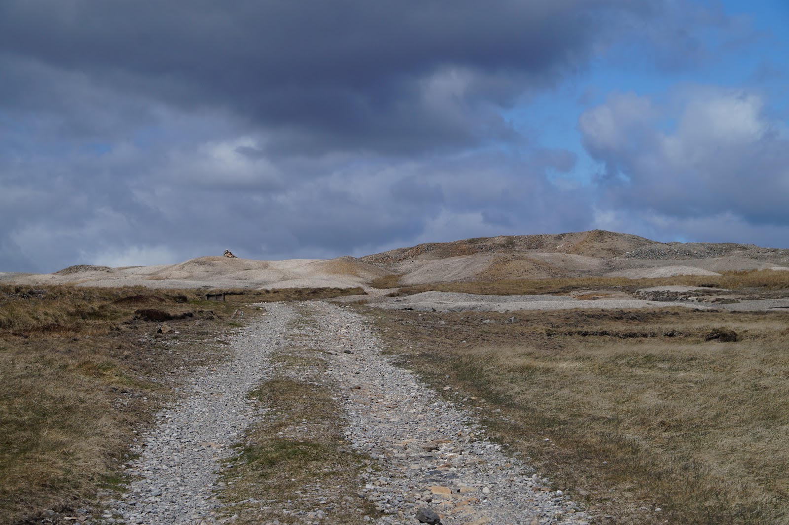
The track stretched out in front of me, gravelled all the way, which was a surprise. It used to be just a dirt track - and usually extremely muddy. The higher up the hill, the deeper the mud! In some places, the track was almost impassable due to the soggy nature of what was underfoot. Not so today! The track has been completely remade and relaid.

There are even channels across it at intervals to drain the excess water from one side of the track to the other.

Now and again, there were sections that showed how it used to be wet, but it was nothing like it used to be. I actually wondered if I had taken a wrong turn somewhere (impossible, as it happens - there aren't any turns to 'wrong'). Once again, we have the grouse shooting for the upgrade:

New grouse butts on the horizon (wooden)

An old grouse butt (also on the horizon), but made of stone and turfed on top
Another couple of cyclists - this time they came from behind and overtook me. I did see them again (from a distance) as they got to the bit I call 'the Wasteland', but that was well ahead of me by that time:

A section of path that was not so well-drained; you could be forgiven for thinking they mined iron ore up here, but really, it was lead:

As I approached the Wasteland, I came upon a very large sheep fold. I don't remember ever seeing it before, but it clearly wasn't new. On closer inspection, it seems they don't have sheep up here any more - grouse have won the day I suppose


The interior of the sheep fold

The wall was completely broken down in some places
Again, I wondered briefly if the track had been realigned, but opposite the sheep fold was something that assured me it was all still in the same place as before:

Seen this old truck many times!
Shortly after this, I reached 'The Wastleland'. This is an area that shows just how unnatural the landscape out here is - much of it has been created from the results of the mining that was prolific. The area must have been very busy and noisy in the past and there are countless heaps of waste from the digging, which nature has still not completely reclaimed:


After the Wasteland, the path turns left and narrows as it passes through a gate in a wall that crosses the path. Just beyond the gate, there is something that always makes me smile - it looks like the stump of a street light! Why would there be a street light all the way out here? And how would it have been powered? I am assuming therefore that it is not in fact a street light, but something else to do with the mining, or maybe a fancy metal gate post. Whatever it was, it is now just a relic of the past.

As I reached the gate, yet another cyclist arrived. He seemed pleased to see another human being; I guess he hadn't seen many since he started his trip. He was not your usual cyclist - he wasn't 30 something, nor dressed in brightly coloured lycra! No, he was more my age - and he didn't have a map! He seemed quite pleased top see that I did have. He was fortunate it was visible. Usually it's hidden in my rucksack, as I don't often need to consult it when in these parts. Anyway, he was looking for Healaugh (which he pronounced Hee-lah; official pronunciation is Hee-law). Anyway, I showed him exactly where we were and how to get where he was going. He set off cautiously and then said he was being careful as he had just been thrown headlong into a puddle. I assume he had come off his bike in that brown, rusty puddle in my earlier photo, as that was the only water I had seen today. Once across the small stream that crosses the path just after the gate,. however, he set off again and disappeared. I hope he found his destination without further mishap.

After the stream, I was wondering where the tunnel was that I remembered. Last time I came up here (with OH), I lost the lens cap off my camera. I knew where I had last had it, so OH set off back to find it (just near the stream I just crossed) while I noticed two tunnels in the hillside. Just as I was wondering where they were, I turned round and saw them - you cannot see tham at all coming from the top, but only if you are going the other way. (He found the lens cap, in case anyone was wondering!)

More evidence of the fact that this landscape is not exactly 'natural'


Eventually, I reached Level House - and sadly it nearly is level now. On previous occasions, there was a lot more of it. Not only has the end wall completely collapsed, it also seems to have been removed. The dressed stone has presumably been used for something else. Shame, but then it's not much use just adorning the landscape and maybe causing accidents - it is very close to the path and could easily have hurt someone if it fell or a bit fell off when someone was nearby.


It is only a few yards from there to Level House Bridge.

If you turn right here, you go out onto the moors (and more grouse butts). However, oddly enough people used to live out here for there is an abandoned farm house called Moor Farm. It must have been very lonely - and a very hard life. No electricity, no running water (unless you count the nearby streams), no sanitation - at least, none that would pass health and safety regulations today! It was here I met two more cyclists, who turned right to go out onto the moor. If you look to the right of this photo, you can just see one of them - I didn't think I'd caught them in the picture, but obviously I did

Anyway, I didn't go out to visit the old farmhouse, but instead continued on down the track towards the old lead mine workings. There is a notice saying it is an historic monument, but mostly it is a heap of ruins and it doesn't look like anyone is doing very much to conserve it.


Never noticed before, but the end of this building is rounded (the other end is square).

Violets are peeping out of the grass nearby.


There are some lovely views to be had from the ruins.


And then Surrender Bridge came into view - from the opposite side from the earlier picture -
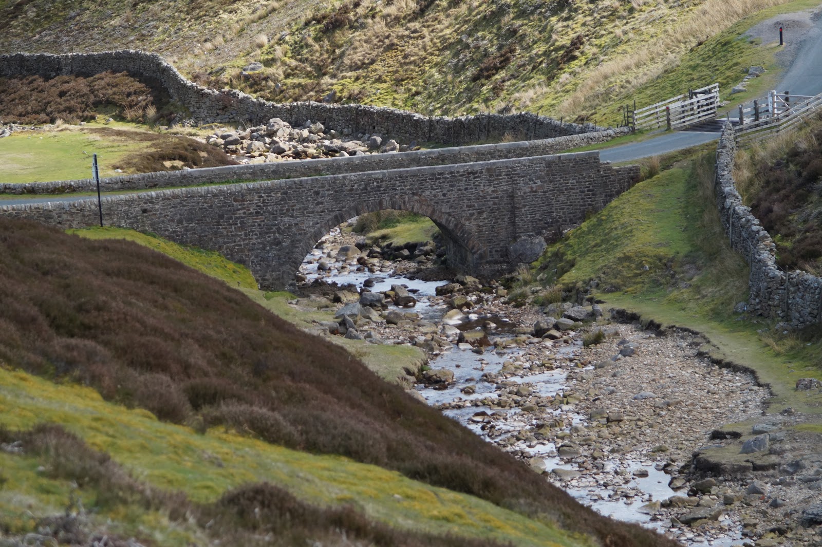
and so did the car

No comments:
Post a Comment